Integrated technologies and methods for acquiring knowledge of and protecting cultural heritage
As part of the design of civil works, it is of paramount importance to verify the impact that these may have on any unexpected archaeological deposits to ensure construction deadline compliance. Until now, the prevailing methodology has been to carry out direct field investigations, mainly by conducting archaeological trials and coring, with a high commitment in terms of both time and cost.
Therefore, it became necessary to identify and accredit expeditious and effective solutions, investing in incrementing in-house expertise and experimenting with more modern technologies that would be useful in verifying any critical archaeological issues within timeframes compatible with those available and at low cost.
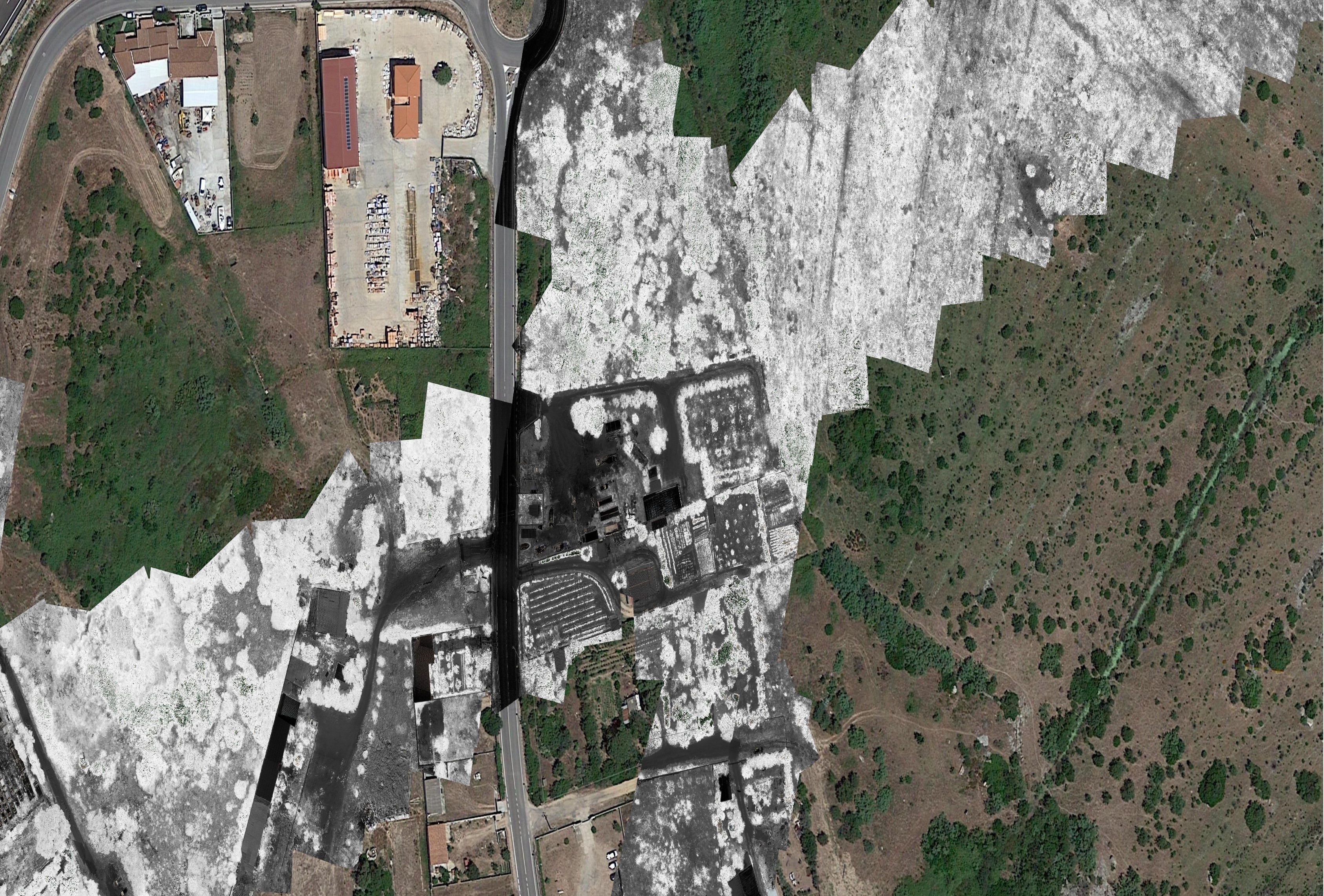
Initial experiments carried out by Italferr's Archaeology Operations Unit have shown that the information potential of such methodologies increases significantly when different remote sensing techniques are integrated with each other. Such a strategy may involve aerial surveys with passive or active sensors and extensive geophysical prospecting. The cases of the projects of the "Olbia Airport Link" and Lot 3 of the Palermo-Catania railway line, the results of which have been presented in scientific publications, have well highlighted the role of "preventive archaeology without excavation," which is now perfectly capable of restoring the archaeological potential of an area and, in the presence of anomalies, of indicating the need of direct investigations, thus avoiding the execution of wasteful and sterile trial excavations.
Within this context, Italferr has further refined an operational protocol that favours the extensive use of geophysical surveys with the aim of immediately assessing the compatibility of the project structure with the archaeological heritage of the affected areas.
Thus, the innovation made is based on two main criteria:
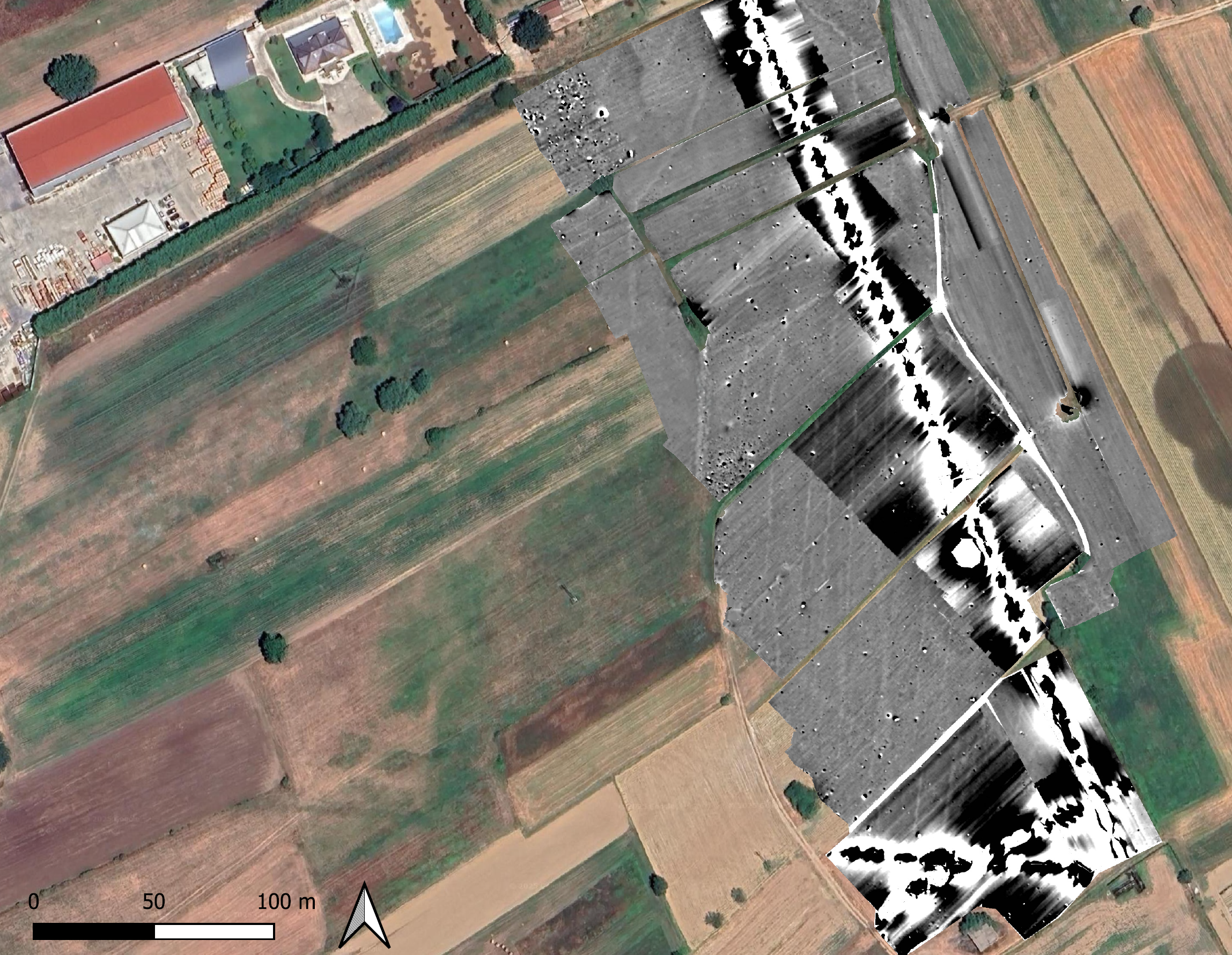
- Sensor integration: to minimize the margin of error from using non-invasive surveys, we use readings that bring together results from different acquisitions (magnetometry, georadar, electrical tomography, electromagnetics, ARP);
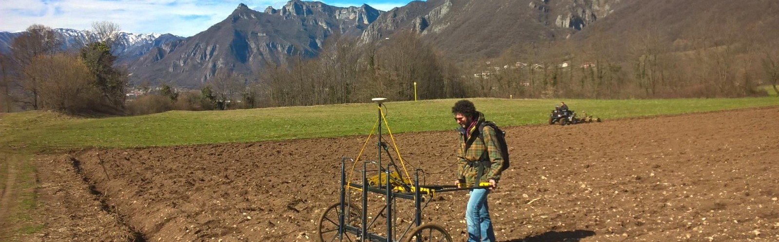
- Introduction of Proximal Sensing: some sensors can be fitted on drones, the use of which allows for rapid sensing of large areas and avoidance of the acquisition phase (magnetometry, Lidar, multispectral, thermal).
Italferr can offer services using single or integrated drone-borne sensors (Lidar, multispectral, thermal, magnetometer) as well as the more traditional terrestrial remote sensing technologies (magnetometry, georadar, electromagnetics, electrical tomography).
More specifically, the technologies used are:
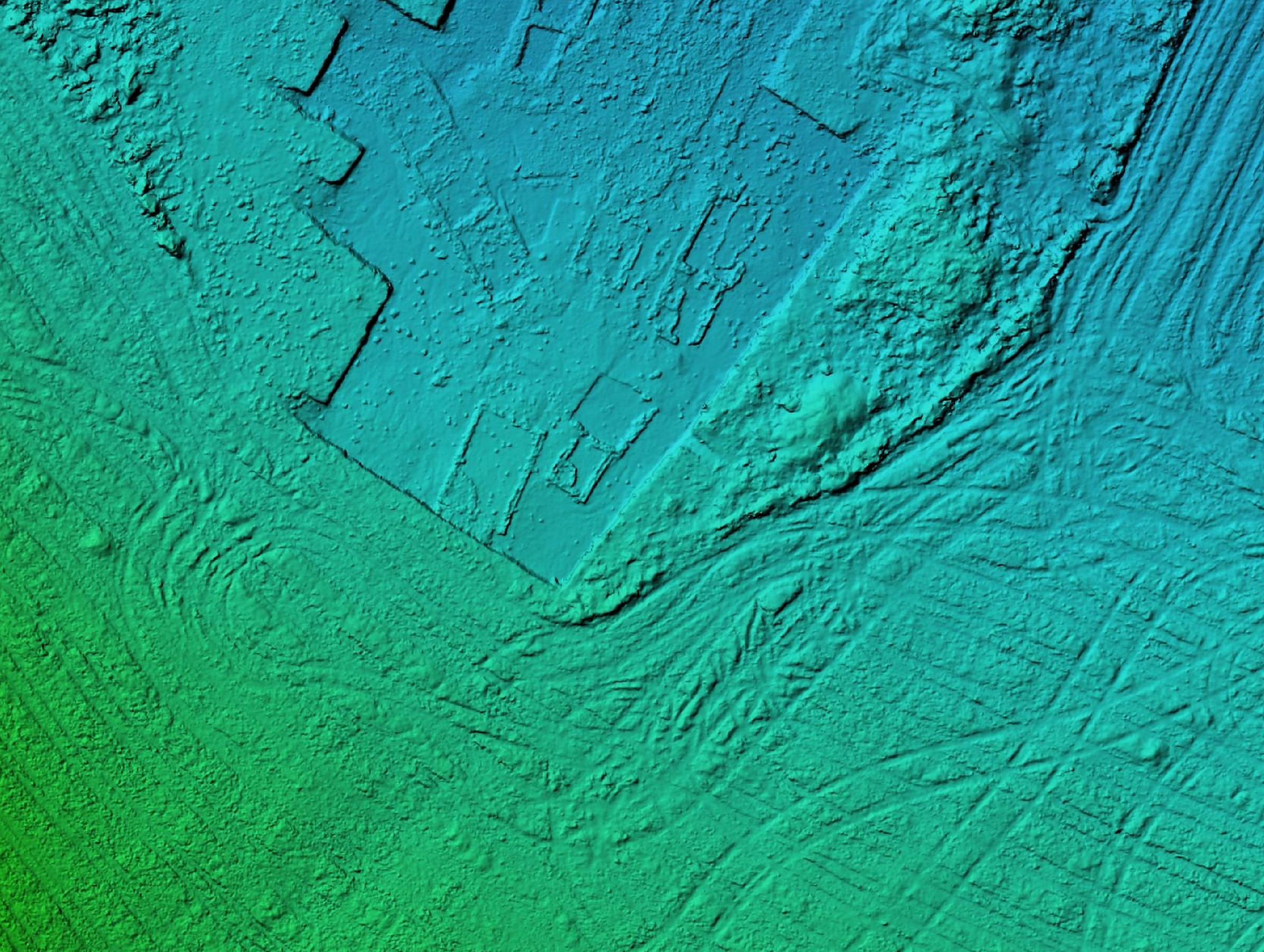
LiDAR (Light Detection and Ranging)
This technology uses pulses of laser light to measure distances and create three-dimensional maps of surfaces and environments. Basically, a LiDAR device emits laser pulses towards a target and measures the time they take to return after hitting the target. With this information, the distance can be calculated with great accuracy, and by combining many measurements, a detailed representation of the analyzed area is obtained. It is a very useful technology in various fields, including archaeology where LiDAR makes it possible to discover and document sites and other archaeological features even under dense forests or terrain that is difficult to explore with traditional methods.
Multispectral
This method uses sensors capable of capturing images in different bands of the electromagnetic spectrum, in addition to visible light. In practice, multispectral images can reveal subtle differences in the composition of soil, plants or underground structures that are not visible to the naked eye. In archaeology, this also helps to identify and map sites in detail when conditions are favorable.
Thermal
Thermal surveying is a very useful tool in archaeology for detecting temperature changes on the ground’s surface or of underground and surface structures. This type of sensor captures infrared radiation emitted by objects that is related to their temperature. In practice, buried structures may have different thermal properties than their surroundings.
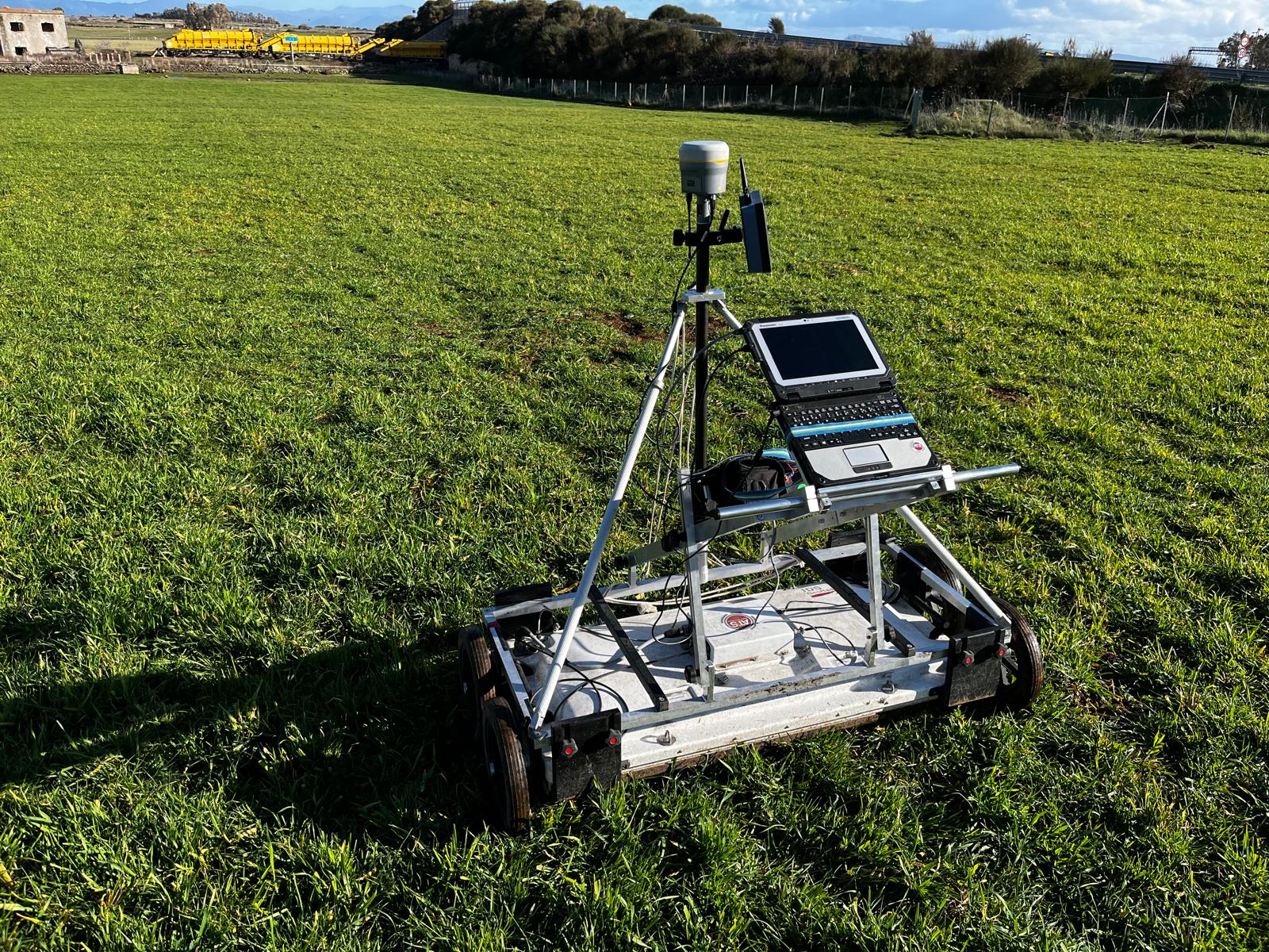
Magnetometry
Magnetometric prospecting is a passive geophysical method and, due to rapidity of investigation, it is the most widely used survey technique in archaeological research. The method consists in measuring the intensity values of the earth's magnetic field or its gradient and analyzing its variations and anomalies. The use of the magnetometry method is recommended in archaeology when there is a need to detect the presence of brick masonry and foundations or fictile funerary accoutrements but, even more generally, when there is a need to optimize the quality of the result despite timing.
Electrical tomography
The basic principle is electrical resistivity, i.e., the resistance that each body generates to the passage of electric current. The presence of moisture in the first few meters of the subsoil makes the soils concerned good conductors of electricity, unlike compact stone structures (remains of building foundations, walls, roads or voids referable to tombs) that are bad conductors of electricity or are insulators. The instrument, usually composed of a pair of injector electrodes and a pair of indicator electrodes planted at minimum depth, measures variations in the artificially induced electric field of the soil. Specifically, the variations produced by bodies in the subsurface characterized by different electrical resistivity are analyzed. This means that buried geometries can be identified simply according to the physical parameter indicating such behavior. The result is a series of vertical and horizontal sections (tomographies).
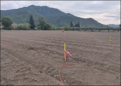
Georadar
Through the emission of electromagnetic waves, this technique allows the "radarstratigraphy" of the subsurface to be obtained in real time. It is based on the transmission of electro-magnetic pulses into the ground and on the reflection and refraction phenomena they undergo during propagation when they encounter geoelectric and geometric discontinuity elements in the subsurface. In recent years, the use of GPR techniques for the detection of archaeological structures has become increasingly popular. Indeed, there has been a significant increase in interest in this geophysical technique dependent largely on the economy of cost and time of execution, as well as on its non-destructive nature and on the relatively simple interpretability of the survey’s results.
Electromagnetics
The electromagnetic method by induction in the frequency domain allows extremely detailed non-invasive surveys of the subsurface. This technique yields excellent results in terms of spatial resolving power and speed of measurement execution. Electromagnetic instrumentation comprises pairs of coils, each consisting in a primary and a secondary coil. In archeology, electromagnetic prospecting is particularly effective in identifying anthropogenic structures, which can be interpreted based on information found on site by our technical staff or provided by third parties, or by means of verification through trial excavations.
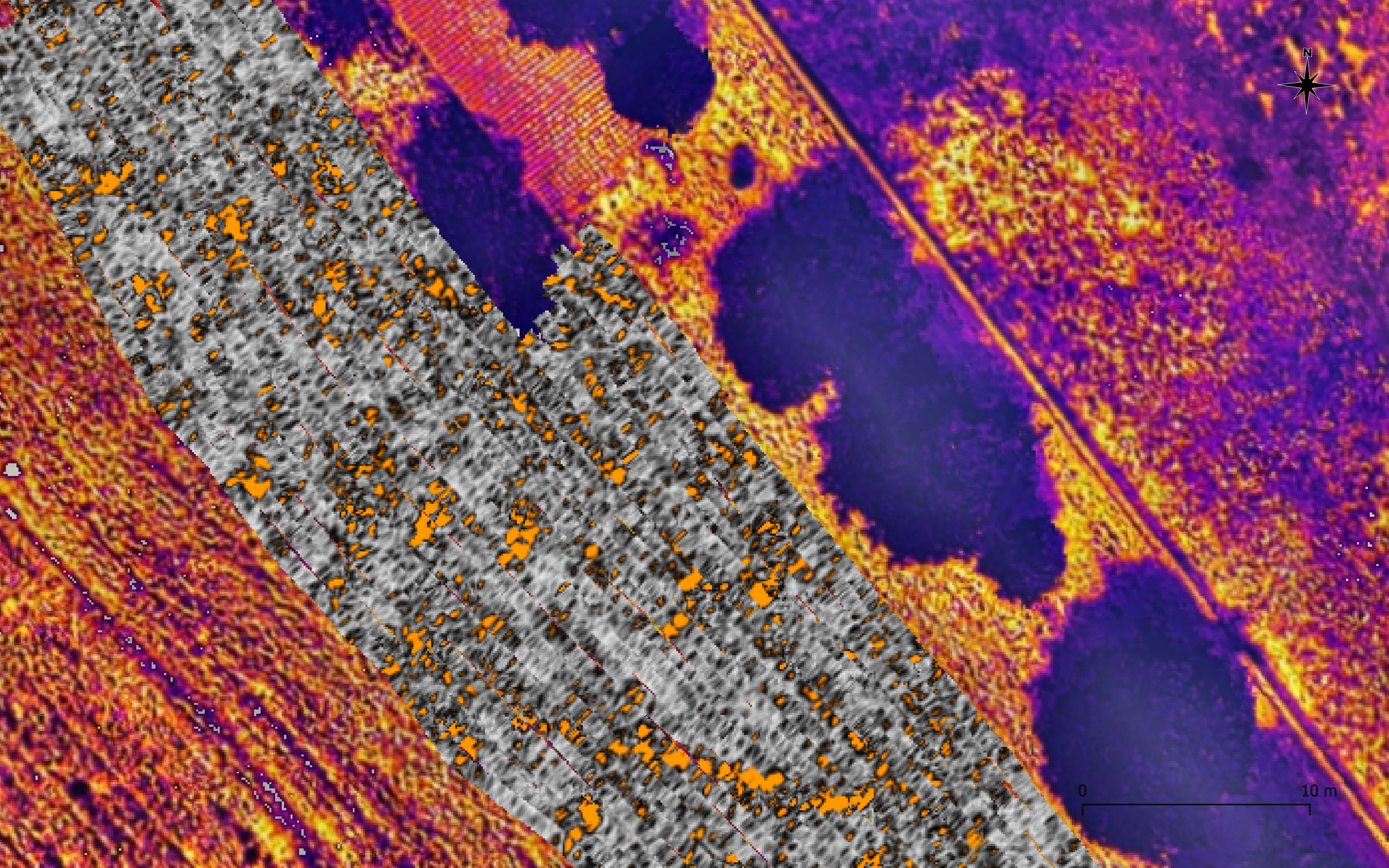
Regarding data processing and interpretation - crucial moments in any archaeological activity - Italferr has developed a dedicated platform where the succession and correlation of data are precisely standardized, allowing for reliable results.
Interpretation of the maps generated through the various remote sensing techniques is carried out through visual analysis and subsequent restitution of the traces via vector drawing on polygonal features to which have been assigned a number of attributes that are related mainly to the type of trace, the sensor from which it is extrapolated, the interpretation and the degree of risk.
This is compiled on a low-medium-high scale depending on the repetitiveness of the trace in the different sensor systems, its trustworthiness, and its place within the context.
Given the large amount of data acquired, in order to optimize data management Italferr is developing, in collaboration with other university facilities and start-ups, a machine learning tool capable of analyzing geophysical data collected via different methodologies and of generating alerts on instrumentation-detected anomalies.
In order to scientifically validate the method, a series of collaborations have been initiated in the academic sphere, such as the activation of an Industrial Doctorate (University of Salento), participation as organizers in University Master's degree programs (University of Tuscia, University of Catania) and a School of Specialization (University of Tuscia), and contributions to the education provided in the field of geophysics applied to Archaeology in several Italian universities (Sapienza of Rome, Federico II of Naples, University of Salento). Furthermore, the Archaeology O.D., in collaboration with the specialist Cartography department of Italferr, has been involved in the project "Integrated methodologies for the acquisition and enhancement of the religious landscape of the Via Appia in the suburbs of Rome (IV-VII centuries)” that has received PRIN funding assigned to the Universities of Rome Tor Vergata and Tuscia of Viterbo. As part of the project, remote and proximal sensing surveys were carried out over a total area of about 20 hectares, the results of which allowed for informed and timely planning of excavation trials.
References
Pastura G., Frandi F., Carrera F.M.P., Gasperetti G., D’ Ammassa C., Manfredi E., F.Pericci 2024, Metodi integrati non invasivi per l’individuazione delle criticità archeologiche nelle VPIA. Il caso del collegamento ferroviario dell’aeroporto di Olbia, in «Spolia. Journal of medieval studies»vol. XX, n. 10 n.s., pp. 634-659
Pastura G., Frandi F., Carrera F.M.P., Gasperetti G., D’ Ammassa C. 2023, Collegamento Ferroviario Aeroporto – Stazione centrale di Olbia: una prima sperimentazione di sensoristiche integrate da drone in VPIA, «Archeomatica», Anno 15, 4/2023, pp.18-20.
Pastura G., Comedini C., Frandi F., Manfredi E., Pericci F., Sordini M. 2023a, Archeologia preventiva e infrastrutture ferroviarie in Sicilia. Indagini di remote e proximal sensing sulla nuova linea Palermo-Catania, in Analysis Archaeologica, An International Journal of Western Mediterranean Archaeology 8-2023), Roma 2017, pp. 135-150
Online sources